Wednesday, October 27, 2010

Canungra Cup

The drive to Canungra.  Big sky.  I'm
used to driving on the left hand side.
I left Manilla and drove to Canungra in Queensland for the 8 day Canungra Cup competition in Queensland.  Canungra is a small town about 100km from the Gold Coast. When you get high enough you can see the coast and Nerang. The sea breeze comes in around noon each day.
The view from launch (facing west)
at the top of Mt. Tambourine
It's a beautiful area with mountain ranges (still not Canada Sized) and valleys, a good change from Manilla flatness. Lots more decision making to be done while XC flying.

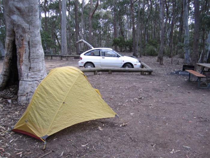
At the camp ground in the sun.
Brekkie has been cereal/coffee.
Found out using powdered milk is
easier than dealing with keeping ice.
I arrived the night before the comp, and set up my tent and woke up to a task the next day. I hadn't even looked at a map until I got up to the hill.  Not a great idea for doing well in a comp.  The rest of this is just me talking to myself about the comp.

First task: everyone tried to get off early in case the sea breeze came in.  Cloud base was low and climbs were super light. I dirted early with a couple other pilots on my first valley transition from Mt. Tambourine to Misery Mt. as I flew through some excessive -4m/sec sink. I didn't even think to push in the direction of the expected valley wind while I was high up (and thus not in it) so I could hit the windward side of Misery Mt. more efficiently. You'd figure after enough valley flying that I'd be thinking of valley winds --- 'cept these don't really look like valleys from high up as there is no snow on the mountain tops!

Retrieves are organized here, so you just give a shout on the dedicated radio channel and the well placed retrieve drivers show up with a bus and cold beer/soda. Seriously!

Dirted, yet again.  Nice looking day!
Second task: Similar day, but this time I survived the first transition and ended up doing about 26 km. Flight Track. I hopped over a few valleys with some small gaggles, thermalled in light conditions, etc, etc.  Impatience led to me heading out on my own on a transition that was unlikely to work, and, well, it didn't work. I need to focus on being patient, and at this point just following the gaggle around (this requires me to thermal super efficiently so I can leave at the top of the gaggle to compensate for lack of glide performance).

Third task was canned due to the seabreeze coming in early and blowing over the back of launch before they had finished the allotted launch window.  This was good because I was playing with my instrument and was working on hitting start times perfectly and ended up heading out on my own (I figured a few people would follow, and I decided not to turn around) and Misery Mt. got me again.  Patience, again... without a gaggle it's very unlikely I can get anywhere.

Waiting for a launch briefing
The fourth task was fun gaggle flying in light lift and cloud base that was low near the coast and rising as we headed inland (less moisture in the air).  The last thermal I was in, the gaggle headed off in what I considered a death glide toward a ridge which was all in shade.  I stuck around and watched them hoping for inspiration.  Well, the thermal I was in ran out and I had no real brilliant ideas so I followed them, hoping to be able to choose a lifty line based on the people in front of me.  As it was there were no lifty lines.  I didn't clear the ridge line and ended up scratching up the ridge while watching someone who had dirted get mobbed by a herd of cows. Luckily he was trying to capture the moment with a camera and the flash scared off the cows!  His wing is grass colored and they were probably just hungry.  I topped the ridge and saw a possible landing zone on the other side, so hopped over the trees into the sunny side hoping for some lift.  A few bubbles but none of the real lift I expected so I landed in the flat green section which already had two other pilots in it (and a third landed after me).  We had a nice long walk out to the road, an essential part, for me, of the adventure of paragliding.  A pilot survived with no injuries after hitting the power lines (the poles were hidden in trees).

The fifth task I worked out what I thought was a good start strategy (it was an entry cylinder and I wanted to enter at a specific point), though the implementation was stymied by unfortunate cloud locations.  Stayed with a large gaggle and floated along until the rains started coming and people started taking their own directions.  I stuck around in a super light climb for quite some time watching the rain in the direction of the task.  When the clouds cleared out I topped up and headed by myself across a big blue hole to get away from another storm brewing behind me.  Well without any thermal indicators and some major sink I ended up dirting again.  Once again, I failed to wait for the rest of the gaggle to get up and decide to head out.  With enough people, finding thermals is easy.  One pilot injured himself while landing by hitting a fence and breaking an ankle and requiring an airlift, and another pilot ended up in the trees unhurt below launch.  I did not see the events and am just writing what I heard.

For the sixth task, I had decided not to launch and was waiting fully dressed up on launch watching most of the pilots boating around in the too easy lift below monster sized clouds which were closing up above launch (a sign things are going to go boom!). They cancelled the task as rain started falling all around.  I packed up my glider and down to the cafe where I am now.  One pilot injured himself while landing (stalled 10m up)--- too much brake, maybe bad landing location.

The seventh task was launching from Beechmont Mt., an east facing site where launch will sometimes get blown out if the seabreeze adds to the normal wind too much (and anyway, you can't escape launch if that happens as all the thermic activity is stopped).  Luckily 5 gliders can setup at once (and well, sometimes launch at once if people aren't paying attention!).  We launched into very light ridge lift and mixed light thermals.  80 people on a small ridge all desperate scratching.  Amazing how well it worked, but there were some stressful moments and an occasional emergency maneuver.  Eventually the task was cancelled due to rain on the course line.

The eighth task was from Beechmont Mt. again. I launched straight into a thermal and got up to cloudbase at 1200m (a typical day here, not too high) and wandered away from the crowds since the start gate was 40 minutes off and about 6km away. Found another thermal, and headed up to base. This time I didn't leave my thermal early enough and started getting some significant cloud suck. I tried a new maneuver: big-big ears and full speedbar (big ears, add some speed, pull the next set of lines significantly, full speed;  if you pull them both at the beginning you might stall the wing; I'm sure this is not too good for the wing as only a few lines are left supporting the pilot). This quickly got me out of the lift, and I headed toward a bunch of gliders at the edge of the start cylinder. Found nothing along the way and ended up scratching low on a set of finger ridges that stuck out into the Illinbah valley. The valley winds were strong enough to make the thermals coming off the tops of the ridges really rough and hard to use and I had a proto-frontal (ie a frontal that I barely stopped just as it was folding) about 50 meters off the deck. That was a clear signal to stop scratching for me, so I headed off the ridge I was on and landed in a nice paddock only about 6km from launch with another pilot.  While packing up I saw a pilot on a 2/3 glider surfing the finger ridges get a full frontal, cravat, and toss his reserve.  The reserve didn't open first try so he hauled it back in and tossed it again, and it opened and he landed under reserve between two fingers.  He didn't immediately move, and I heard no information on the radio so another fellow started bushwacking up the slope.  I quickly put on shorts and my radio anticipating quite a walk and started hacking up the hill.  Shorts was a very bad idea as there were plants with thorns 5 cm long, but no blood no adventure, so I'm still happy!  The pilot was OK, no injuries though his wing is a total loss due to the thorns.  Another pilot landed on a neighboring ridge to assist, which I think might have been a bad idea since he had evidence from the other pilot going down on reserve that the air was rough.

I ended up quite low in the competition ranking since I never made goal, but I feel I learned a lot.  They put on an open Q&A seminar during which I learned a lot about how comp pilots think.  Main issues are: hydration   and food, observation skills, and an occasional rest.  Do you land after 2 hours or so?  probably your concentration is flagging: wizard needs food badly!  You need to be looking all the time--- practice with a friend next time you are flying: shout out on radio what you see --- try to be the first person to see something useful: clouds growing, other pilots climbing, cloud cycle times, sun, shade, rain, birds, wind indicators, etc.

Wednesday, October 20, 2010

Wedge tailed eagle attacks!

The last couple days have been good XC flying days.  Or, as they say here, it's been "on like a train".

Yesterday, after hiking up the hill, I flew about 63 km toward Bingara (Leonardo Link). The day was fun, with a moderate inversion between 1100 and 1400 m or so that made flying tricky (it's not obvious on the track log, but it sure was obvious while flying not just from the haze but the weakening of thermals through that region). I launched relatively late at around 1:30pm and simply followed the highway until it started getting late at which point a confluence of decisions ended up with me dirting, the most important of which was the worry that I would be standing on the roadside until it was dark. After the expected hour of standing on the side of the road eating muesli bars and drinking water, along comes a familiar looking truck. Soon enough I realize it's the same bloke who picked me up a couple weeks ago! I helped him unload a pallet of flour at a bakery and he dropped me off right outside the pub I am staying at.  My car was still at the bottom of the hill, only a 2-3 hour walk away (any walk in the Australian sun requires preparation in terms of sunscreen and water), luckily my magic thumb got me there pretty quick too the next day with only a few kilometers of trudging.

A wedge tailed eagle.
This photo is by Fir0002/
flagstaffotos
and is released under the 
GNU Free Documentation License.
Today looked like it was going to overdevelop, so we pushed to launch relatively early, and I had to pull out my favorite sort of launch: the nil wind reverse. Soon enough I was up and out under some almost Cumulus Congestus (it never did end up raining). A repeat to yesterday, I headed with the wind along the main highway trying to catch another pilot who had launched quite awhile before me. Zoom zoom at speedbar under the clouds and I still couldn't catch the guy. I used my new method of launching in my light gloves and putting on my heavy gloves on the first glide if it is cold enough. Worked well! I reached the Tarpoly Sink Hole soon enough and drifted across it slowly only to find that my weak tail wind was now had a weak head wind, which I figured could be used to get me back to the farm. So, I turned around and headed back.  It turned out this was only a local effect, probably due to the way the valleys split here.

On the way flying back to the farm, I watched a couple wedge tail eagles play fighting (I think) above me.  They are probably a mated pair and the same ones I've flown with a couple times already.  Soon enough they noticed me too and swooped down to play.  They were riled up from play fighting and decided to give it a go with me too, which involved some diving and swooping at my wing with talons outstretched.  I used the technique I last saw a pilot use to fend them off which involved flapping the brakes on my wing just before the wedgie would hit it and the wedgie would then veer off (I have no idea why it works, but they balk just when you flap the brakes). This worked for awhile, but I figured I needed to get creative to get away.  Last time I spiraled down, but the timing wasn't right for that thought as it seemed that starting a turn to enter the spiral would cause my wing to get even closer to where the wedgie was. Instead, I spun the glider on the side the wedgie was coming from and exited to a full stall (I think I mentioned before in this blog that I feel more confident stalling my wing than doing proper spin exits --- this being a new glider I didn't even consider trying a proper spin exit.  Big hole in my piloting skills and evidently there is no place where they have flying over a lake / SIV in all of Australia for me to work on it!).  The glider didn't try and kill me: I think it behaved rather nicely.  Off I flew figuring that would end the war.  Not so!  Since I had now awoken the acro-monster, my next avoidance maneuver was to start big wingovers.  After exiting with an almost loop one of the wedgies came right back.  Finally, an asymmetric spiral figuring if I ended up landing at least the wedgie would probably leave me alone.  Finally success! The remaining wedgie who had been harassing me was nowhere to be seen.  With very little height remaining, I started floating across the valley in some convenient light lift to go and land near the road when the wedgie reappeared from above and with a final squawk and dive dug a talon into the left topside of my wing.  That was it and off she went, I guess she figured I wasn't going to be tasty (no resistance when she tore into my wing) or she had won the play fight. Looking up, I could see bright spots in the shape of a talon and luckily no big rips so I headed into land, breaking my rule number one: do not land midday! I ended up attempting a PLF (parachute landing fall; ankles, knees together, tuck in your arms and roll when you land) because the field was super bubbly.  It worked much better than my last attempt which was little more than a face-plant.

A gift from a wedge tailed eagle.
I didn't have to take a first aid course
to get my paragliding license for no
reason!  I think an OK job of
applying band-aids to my wing.
Got picked up almost right away by the same person who picked up the pilot who had launched before me --- I guess she figured two paraglider pilots in a car can't be worse than one.  A quick ride back and I got some white repair tape (I only have yellow tape in my emergency kit) from the local instructor, who mentioned that I probably made too much noise and that might have set off the eagle.  A bit of repair work and it was time for the landing beers and some retelling of my adventures.  The repairs will be tested tomorrow in what should be great XC conditions.  There are several stories on the internet about wedgie attacks on paragliders.  Here's a nice link to a youtube video of an attack in progress!  I feel lucky in comparison with that pilot.

Wednesday, October 13, 2010

Mt. Kaputar

More road obstacles.  People say
these guys stink if you move them, so
I didn't try and detoured around.
Obstacles while driving to Narrabri!
This guy wouldn't move off the road so
I had to drive around him.
A wave of bad weather (good for the farmers though!) has been occurring in large sections of New South Wales, so I pulled the plug on paragliding in Manilla, packed up my car and headed off to explore some more of the local area. In this case first toward a town called Narrabri. As usual around here the trip was slow on a mix of asphalt and gravel. The gravel isn't an obstacle even with the tiny wheels on my car, but the wildlife sometimes is.  I had to detour around a lizard and a turtle that figured the road was for sunbathing.

Nandewar Range. Mt. Kaputar is
1510m tall!  An actual mountain!
Forests!
Well, Narrabri was somewhat uninteresting (unless you want to visit the Australian Cotton Center) so I had lunch and headed to Mount Kaputar National Park. The national park comprises most of the Nandewar Mountain Range that was formed from an ancient volcano 20 million or so years ago.
Views from the mountains.

In the range there are real mountains, real forests, and even rainforest flora in a few spots! I felt quite at home.

Camping at the top of Mt. Kaputar.
My car is small, but my tent is even
smaller!
So, me and my little car crawled up all 1510 meters of the highest mountain, Mount Kaputar. By the time I made it to the top, it was getting late, so I settled into the campground at the top of the mountain where the guide-pamphlet promised Hot Showers and Toilets for $5. After a sublimely quiet and somewhat exotic dinner of turnips, muesli bars, pistachio nuts and beer I retired to read. Soon enough it began to storm. I've had my tent up through a lot of bad weather including some severe winds which have taken slightly less aerodynamic tents and rolled them like tumbleweeds, but this was too much. I figure I spent the night inside a cloud, which might explain the explosive nature of the wind gusts. You could hear them coming through the trees well in advance. Midway through the night while I was contemplating the necessity of getting up in the cold, wind and rain to pee, nature made the decision for me by ripping the stake that was holding my vestibule/entry way open out of the ground. Since that was all that was keeping my shoes dry, I was forced to head outside for some repair work

Next morning it was still raining, so I skipped breakfast, abandoned the idea of hiking and headed down the mountain hoping the roads were still there with visions of a big breakfast in town. I left early enough that the kangaroos were still quite active, and finally my camera quick-draw skills let me capture them on film! I had to do it through the car window otherwise they would run away. So here is the final proof I am actually in Australia.
Roos in the mist!
Well, the day was just starting, so I drove farther on to Moree, yet another small town, where I have now settled into a pub (the pub names are all the same, it's either the Royal Hotel, Post Office Hotel, or the Imperial Hotel, and in fact even the smallest towns have all three) and am planning to go to the local hot springs tomorrow in the rain.  As a travel hint, McDonald's is the best source of free WiFi internet access in Australia (though I am writing this post through a broadband internet stick at the pub).

Thursday, October 7, 2010

Light Manilla Flavor

Light Manilla Flavor Air
The season is starting in Manilla, but so far, it's been scratchy at best. Two days ago I and the other XC pilots sank out during what I figured would be a great day after only 14 km at the Tarpoly Creek Sink Hole. This is evidently common as Tom, the local hotel/bar-keep, asked me where I got to and I said "Tarpoly" and he finished it with "Sink Hole". The distance wasn't the best part of the flight though --- it was flying with an eagle that topped the day. I was in a thermal with the eagle on my wingtip, a beautiful moment, which I proceeded to ruin by trying to get my camera out and take a photo. The disruption in my pattern made the eagle unhappy and he promptly started diving toward my wing and squawking. Another pilot, Andy, who I was flying with suggested over radio that I should just talk to the bird to calm it down (this was similar advice to the time I was trapped in the back of a canopy-ed pickup truck with an angry dog... the owner told me just to talk gently to the dog and I'd be OK). Anyhow, I tried talking, but eventually just dove down a little figuring the eagle would leave me alone. Which he did, and instead he headed right over to attack the other pilot who avoided damage by flapping his wing madly. Meanwhile, I fiddled and fiddled with my camera trying to capture the bird with no success. My one handed thermaling technique needs work (note I would only do this photography attempt in light conditions).

Looking at the landing zone.
Today was another prime example of what I figure should be called "light manilla" flavored air. I launched into very light lift, and using every bit of focus I had, worked it back to launch and above.  This convinced several pilots to try it too, but they all bombed out so I was left with the eagles only to fly with. That gave me some time to try out some photos and a short video (I'm hand holding the camera, so the jerkiness in the video is due to my bad one-handed thermaling technique which you can also hear by the variations in wind noise).

Tuesday, October 5, 2010

Earning my turns

Mt. Borah from the LZ.  I guess
Hill Borah wouldn't sound as good.
The Weekend Warrior Series friendly competition in Manilla was plagued by rain and high winds. So much so that the only possible taskable day (Monday October 4th) was looking like it might be cancelled because the road up the hill had turned to mush. Since it looked like a good XC day, a small crew including myself decided to hike up in case the road stayed closed all day. Just a few minutes after we reached the top of the hill, and about an hour from starting, we were overtaken by the Manilla Basher, the non-organic transport of choice up and down the hill. Still, we had "earned our turns" by hiking and at least were rewarded by flyable conditions. The task was to fly over the back of the Mt. Borah  and about 25 km to the Boggabri Gap. Woo! Time for my first cross country flight from Manilla.

The Basher and the front of my Festiva
I launched into strong winds and straight into a crowded ridge soaring pattern mixed with ugly thermals. Getting away was tricky due to the density of pilots, so one had to just hope to gain enough height on your first 360 to clear the highway of ridge soaring people. After some frustrating and somewhat scary moments --- I even tried and failed to top land to get out of the pattern hoping to try again later after it thinned out --- I finally escaped. I lost my thermal way below cloud base, and the wind/compression over the hill was too strong to go back to the launch so I continued over the back of the mountain and happily blundered into some zeros. I circled in them gradually drifting with the wind toward goal.  With plenty of time to sight-see I soon realized there weren't any real roads back here --- just dirt tracks. I had interpreted someone saying "There are plenty of roads back there, with the tarmac'ed ones having more traffic, so aim for them" as meaning I'd have no problem getting back by hitchhiking. I wasn't so sure anymore. Well, I was too busy staying in the zero lift thermals to worry too much, and I figured I could always beg for a retrieve on radio. Back to floating in zeros and watching the clouds develop.

Not raining this direction yet!
Unfortunately, time was not on my side as rain cells formed to both the north and south and were heading across the course line. I probably could have kept going, but, as they say, I'd rather be on the ground wishing I were in the air than the other way around. I landed near the intersection of four dirt roads, called "Four Way" after a very last minute course adjustment to avoid landing in a paddock with what looked to be a lone (hiding!) bull in it. I caught a ride just before I thought I was going to get rained on.

You shall not pass!  Just cows on the
road.
Flying here in the almost flats is very different. It seems you can be 30 km away from a rain storm and not overly worried, whereas in a mountain/valley system the gusts from the storm can travel much farther, so much so that even storms you cannot see can get you.

The next day, conditions were much nicer, and I flew north with another pilot to Barraba (35km) in light but fun conditions. I decided to land just past Barraba, in part I wanted to see a new place and was a bit hungry, but mainly because the acro-monster inside me was itching for a throw-down instead of continuing on farther north in the super scratchy conditions. I burned 1200m practicing wingovers and asymmetric spirals (and now I can say that yes, as I suspected, this is a real fun wing to throw around) and landed near town. The town looked small from the sky, and, well, even smaller once I walked into it.  A local pointed me to the only open restaurant where I re-hydrated and re-glycemated.  I caught a ride back to Manilla with a friendly truck driver / ultralight pilot who had already picked up the pilot I had been flying with (and who made something near 65km)!

Returning from Mt. Borah after my flight to Barraba.
Note the slight sunburn despite SPF 30 sunscreen and wearing a hat all day.
I learned in discussion that Australia is the skin cancer capitol of the world.

When in doubt, adventure

Near the beach landing zone at Stanwell
Park. Launch is on the top of the knob.
Looking down while scrambling up.
Steep!
On Sept 28th, I headed to Stanwell Park, a coastal ridge soaring site a bit over one hour south from Sydney by train. I didn't bring my paraglider since the winds were predicted to be cross and too strong. I arrived armed with my backpack with laptop, gps, mobile phone, and a sweater. It wasn't too hard to find the landing zone, as a couple hang gliders had just finished folding up. I wanted to see the launch site though, and decided to eschew automotive transport and hike up. I wandered along the roads for awhile and then followed a rough trail into the woods. Quickly it forked with one direction going into a very dark underground tunnel with a broken gate that felt to me like an ideal criminal hideout, so I moved past it too quickly to even take a photo. After awhile of walking I was frustrated with not actually going up the hill, and took what I figured was an overgrown side trail that headed straight up the hill. After a few dozen meters of vertical scrambling I had to decide whether to go back down or keep going. 
Who left that here?  It was joined by
many broken beer bottles on the hike
from the beach to the top of the hill.
Up was a lot easier, and I judged the whole hill wasn't higher than a couple hundred meters, so no problem, eh? Scramble, scramble. I passed by a broken car embedded in the scrub that someone had recently committed to nature via high speed off the hilltop.
Arriving at the Stanwell Park launch.
Finally just after failing to clear some spiky plants which left bite marks on my hands, I arrived sweaty and tired at the top of the hill to the surprise of a local who was smoking in the strong breeze (more Aussies smoke than Canadians; probably the extra heat from the sun causes spontaneous combustion). I gave my recommendation that the scramble was one way and best avoided anyway. But, no blood, no adventure, so I was satisfied.
Bondi beach in the distance.  The
people weren't so pretty at 11AM, so
I took a photo from far away.

Tired from adventuring, I spent part of the next day at Bondi beach in Sydney mingling with the pretty people. As I result I have to update my Sydney summary: If you displaced Tofino with Vancouver, grew some real transit and pushed the density a bit, you'd have a very rough approximation of Sydney.

Since cities do not have night skies, we are left with the possibility of ocean, forests, and the mountains to cure city-induced mental ills. Save money on therapy and just move to a beautiful place and use our evolutionarily developed anti-depression medicine.